


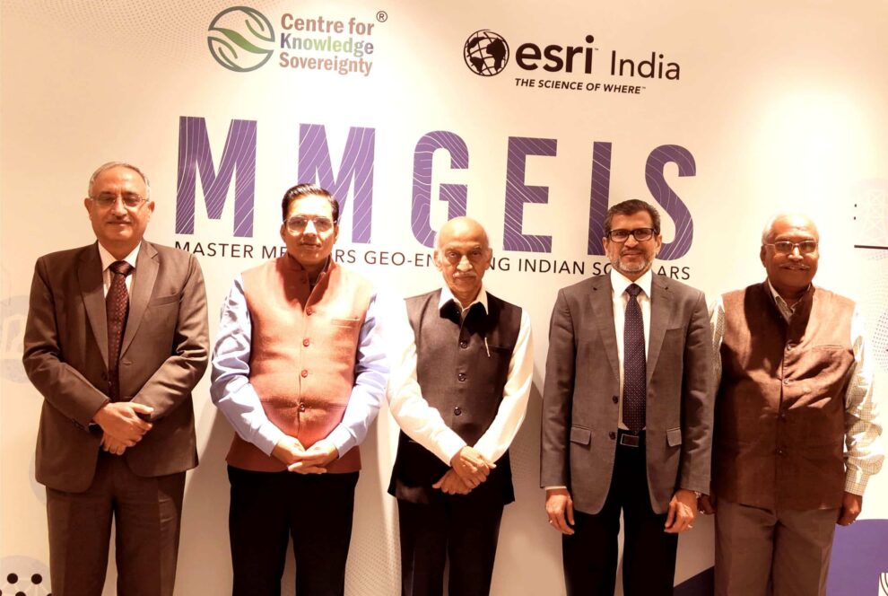
Multinational geographic information system company Esri India and independent public policy think tank Centre for Knowledge Sovereignty (CKS) have unveiled the pilot phase of the Master Mentors Geo-enabling Indian Scholars (MMGEIS) program to train students across the country in geospatial technology.
The students will be guided by a team of experienced professionals including A. S. Kiran Kumar, former chairperson, ISRO and currently a member of Space Commission, Dr K. J. Ramesh, former director general of meteorology, IMD, retired lieutenant general Girish Kumar, former surveyor general of India, Vinit Goenka, secretary, CKS and Agendra Kumar, managing director, Esri India.
The free-of-cost program aims to instil geospatial thinking in students from eighth grade to undergraduates, with the ultimate goal of positioning India as a global geospatial technology hub. Over the next five years, the initiative aims to engage more than 100,000 students annually, contributing to the development of a skilled workforce.
Key Highlights of the Program
The online MMGEIS program spans four months, divided into three modules, offering video-based courses accessible via mobile phones or laptops, reading materials, as well as proctored exams.
The MMGEIS program is strategically crafted to cultivate a research-oriented mindset among students, equipping them for the challenges of the digital age while concurrently establishing a strong intellectual property (IP) framework. Its impact transcends technological realms, extending into the domain of entrepreneurship, offering valuable insights into patent filing procedures and guidance on initiating startups. The program, therefore, serves as a comprehensive initiative to develop not only technological skills but also entrepreneurial acumen, contributing to a well-rounded education for participants.
The pilot phase, covering 1,000 students initially, will roll out in select schools and educational institutions, with plans for broader implementation starting June 2024.
Some of the notable activities leading up to the pilot phase include a roundtable discussion of industry leaders in Delhi, a visit to the ISRO Telemetry Tracking and Command Network (ISTRAC) center, and the launch of the MMGEIS website.
“It is important to enable and empower curious young Indian minds with the tools and knowledge to understand the use of geospatial technology which is rapidly encompassing all aspects of human endeavors. MMGEIS is a powerful medium that will bring to these bright minds the right guidance and skills to usher in an era of innovation in the use of geospatial technology.” said A S Kiran Kumar, during the announcement.